Training Platform of Slopeland by Using Virtual Reality
Developing history
To reconstruct and visualize the disaster sites, RTDP has built the real-scene 3D model by using unmanned aerial vehicle (UAV). For building the training platform of slopeland, the technics of virtual reality (VR) are chosen. Moreover, the geospatial data produced by investigating reports every year was inputted in the VR training platform. Hence, this training platform can help the rookie engineers to understand and clarify the problems without visiting disaster sites by themselves. Besides, this training platform provides the function that the users from different agencies or places can discuss and plan the remedial engineering in the same virtual space after disaster.
In conclusion, this VR training platform can provide not only the real-scene 3D model after disaster for rookie engineers, but also a virtual space to discuss the remedial engineering safely.
Framework and
functions of platform
functions of platform
1
Flowchart of building 3D model by using UAV
Flowchart of building 3D model by using UAV
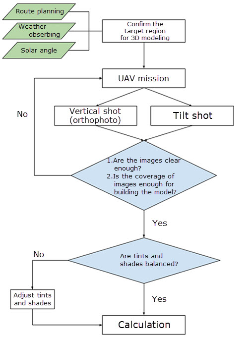
To build the VR training platform, there are 3 parts of steps. First of all, the aerophotos taken by UAV should have higher scan overlap rate. Right after this, the real-scene 3D model would be built by using the ContextCapture numerical program to deal with the aerophotos. Last, a VR environment with 3D model would be developed by Unity program.
2
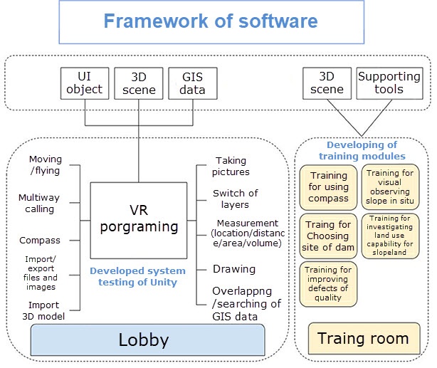
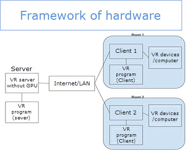
Frameworks of platform
Frameworks of platform
3
Seven fundamental modules
Seven fundamental modules

4
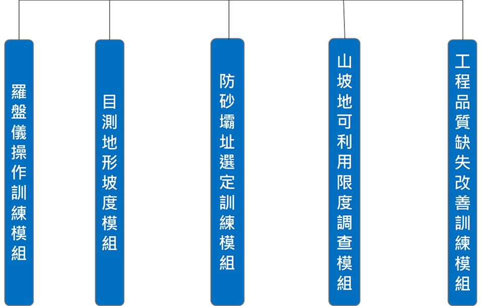
Five training modules
Five training modules
Introduction of training modules
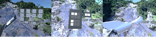
Training for improving defects of quality
-
Purpose
Learning to distinguish the advantages and disadvantages of engineering in situ. -
Process
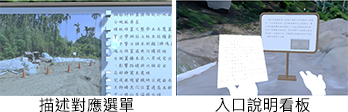
- Enter the training module
- Read the manual of this training
- Pick up the document of quality defects
- Find the items on the document in this scene
-
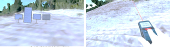
Training for visual estimation of slope in situ
-
Purpose
To determine the slope of the terrain by visual observing only. -
Process
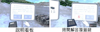
- Enter the training module
- Visual-observe the slope where arrow pointed
- Choose the result by observing on the board
- Click the button to show the answer
- Go to next stage pointed by arrow
-
Training for investigating land use capability for slopeland
-
Purpose
Learning to investigate land use capability for slopeland. -
Process
- Enter the training module and move to the chosen place
- Start investigating land use capability for slopeland
- ※ Judged in-situ factors of land use capability for slopeland are divided into 4 parts: (1) slope (2) depth of soil (measured by soil auger) (3) erosion depth of soil (4) properties of parent rock
-
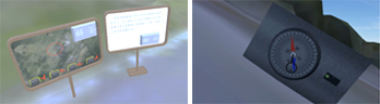
Training for using compass
-
Purpose
Learning to use the compass and read the data from it. Furthermore, to choose the correct symbols for demonstrating is also learned in VR training platform. -
Process
- Enter the training module
- Read the manual of this training
- Use the compass to measure the strikes and dips
- Choose the results (symbols) by measuring on the board
- Click the button to show the correct symbols
-
Training for choosing site of sabo dam
-
Purpose
To teach users observing the in-situ condition after disaster and draw up the sabo dam’s arrangement in the case study of the landslide at WuShen temple. -
Process
- Observe the real-scene 3D model after disaster in VR environment
- Adjust the size, direction and location of the imported sabo dam model
- Click the finish button after adjusting
- Click the presenting button to show the model planned already
-
Benefits and
prospects
prospects
Increasing the visibility and intuition of disaster prevention
- Demonstrate the true condition by building the real-scene 3D model
- Display the true-scale 3D model in VR environment
Demonstrating and discussing in one virtual space
- VR-connect by Internet instantaneously
- Discuss the engineering projects in different agencies and places
- Increase the efficiency of work
Training by using immersive interaction
- Break through the traditional training mode
- Deepen impression of training by using VR interaction